Postcards from Southland, New Zealand
I’ve got this thing about going as far north or as far south as I can. Eight months ago, I stood at Cape Point, South Africa. At 3,900 miles (6,248km) away from the South Pole, that was the farthest south I had ever been. Then.
But like I said I have this thing, so when I arrived in New Zealand in November, it was almost natural that I needed to make a trip to Invercargill.
Invercargill is New Zealand’s southernmost city, and when I told my parents (who had studied in NZ in the 1960s and are somewhat familiar with the country) that I was headed there, they were bewildered. “What is there to do in Invercargill?”. I wouldn’t want to compare the city with the rest of NZ but the impression that I got from my parents and Kiwi friends was that Invercargill is so far south there isn’t much to do there. This, of course, made me want to visit even more.
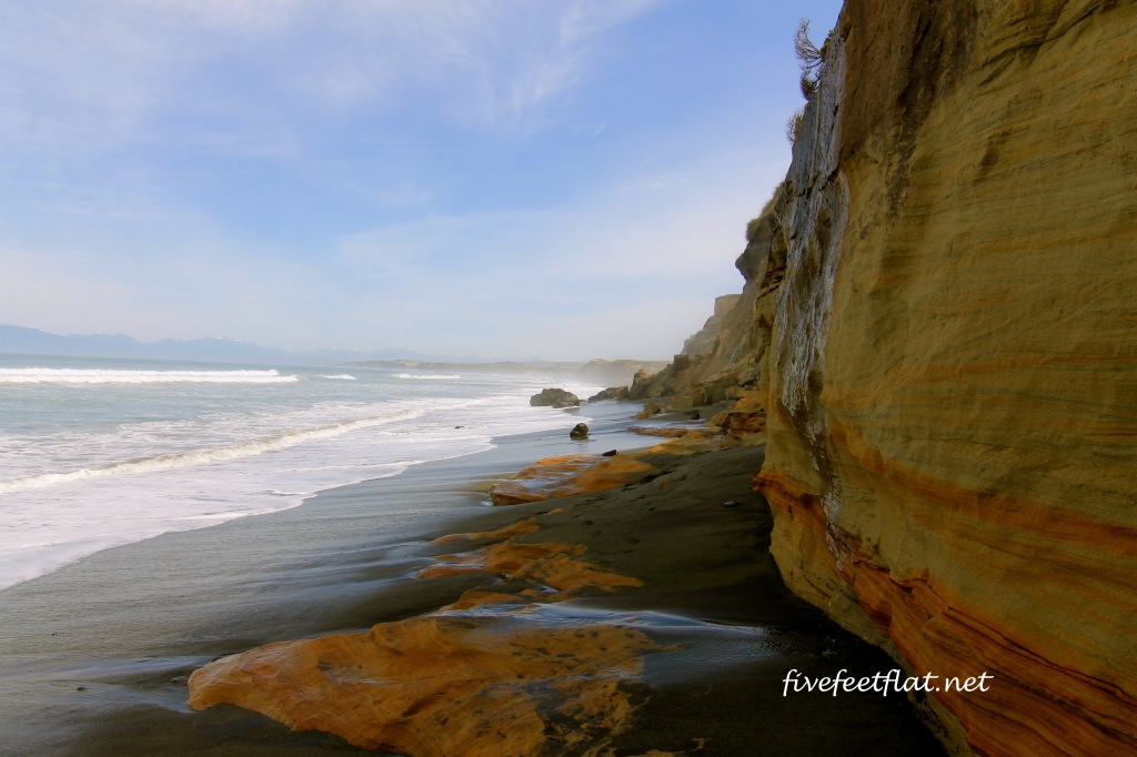
This is Gemstone Beach, some 60 miles (90km) from Invercargill, with its ochre-coloured cliffs:
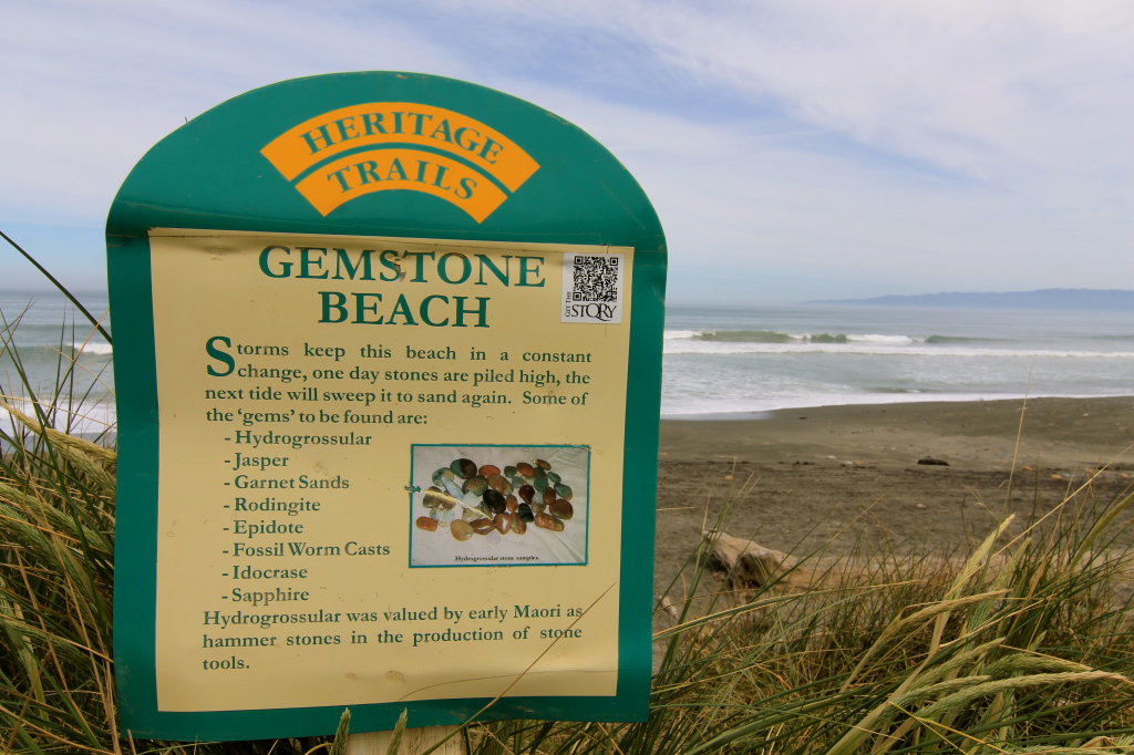
Here’s why Gemstone Beach is really interesting: back in the 1800s people discovered gold in the black sands and before long the nearby town of Orepuki became a gold mining settlement. Now you can still see people prospecting for gold on the beach but it’s far easier to find semi-precious stones like garnet, jasper, quartz and even sapphire just lying about on the sand.
I found a few interesting rocks (which I’ll need to get polished one day) just by walking along the beach and kicking the sand around with my feet. I didn’t even need to dig the sand; most of the time you’ll find these stones on the surface of the beach itself. My pockets were full of stones and sand on the way back.
At another beach not far from Orepuki lies Monkey Island. Don’t ask me how it got its name, I’m still trying to figure that one out:
But of course this *thing* for going south meant that I now had to go to a town called Bluff.
Bluff is a settlement that lies even farther south than Invercargill. When you arrive at Bluff it means that you’ve arrived at the bottom of the South Island. Going there brought me nearer to the South Pole, which is only 2,990 miles (4,810km) away.
So what does one do when one reaches the tip of New Zealand? One goes for a walk. There are quite a few hikes in the area but I chose the Foveaux Walkway, which goes along the coast around Bluff.
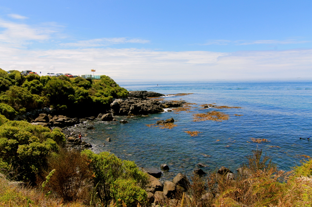
The walk begins at the carpark close to where the signboard is located. The coast is quite spectacular, and on a clear day you can see across the Foveaux Strait to Stewart Island, another island I’ll have to visit one day.
The dark orange bits floating near the rocks is kelp, thick and long:
The 7km track is well-marked and a fairly easy walk, with hardly any incline. This should take you about two hours, to and back.
All along the track you’ll see trees and ferns native to New Zealand, except when the walkway opens up and you get to see the coast. There’s also a lot of birdlife along this route, so if you’re a keen birdwatcher, you won’t be disappointed.
The Foveaux Walkway was the first walk that I did in New Zealand this time. When I planned this trip, I thought it was befitting that Bluff was located right down south, which meant that I would be working my way up. All I need to do now is to get to Ushuaia in Argentina and I’ll be happy, but that’s for another day.
© 2015, Anis. All rights reserved.


Very nice pictures, Anis! I love the blue of the water!
Cindy
Invercargill can get cold even in the summer but it was perfect the few days I was there!
Hi Anis there use to be a monkey winch at Monkey Island to winch boats in to get supplies off ,. Monkey island was the first town ship to be formed it got moved 3 times and is now in its final resting place for many years to come Orepuki 150 years old .
Thanks, Corina, that explains it! Thank you for dropping by 🙂
Thank you for shearing photos very nice looking back on my childhood days
Hi Rose, I’m glad :). Southland is a lovely part of New Zealand!