Bukit Kutu- just another hill
Step.
Swish.
Skid.
How many times will I need to slip on this stupid hill? I asked myself angrily.
It ended up being a game. I would count the number of times I skidded on the mud going down Bukit Kutu.
Which was funny, because ‘Bukit Kutu’ is a lie. It’s a hill that isn’t a hill at all. And the fact that I found climbing it such a chore made the whole thing even funnier, considering that I’d climbed higher peaks overseas.
“I hate to sound like a diva but I’ve walked farther than this and done higher mountains in Indonesia and New Zealand, but this is like, really annoying,” I turned to speak to Mani, realising only a split second later how spoilt I sounded.
“Yes, you are a diva,” Mani replied, and we laughed. It was about 5.30 in the evening and the jungle was quiet. Our long-drawn laughter was the only sound we heard. Anyone nearby would have wondered what on earth was going on. For me, being able to laugh was a relief, an excuse to stop for a while, a sign that we were still okay.
We had been descending and were about halfway through a bamboo jungle when a strap on my backpack got caught on something. I had tugged on the strap and as a result skidded on the wet earth and had just been able to stop myself from landing on my behind.
I wiped my hands on my trousers, which were now an olive green with muddy patches of dark brown. Cleaning this will be so much fun.
The thing about Kutu- in fact, the thing about hiking in general- is that it’s all in the mind. One’s fitness level and stamina are important but most of the time it’s how you deal with your circumstances that makes the difference.
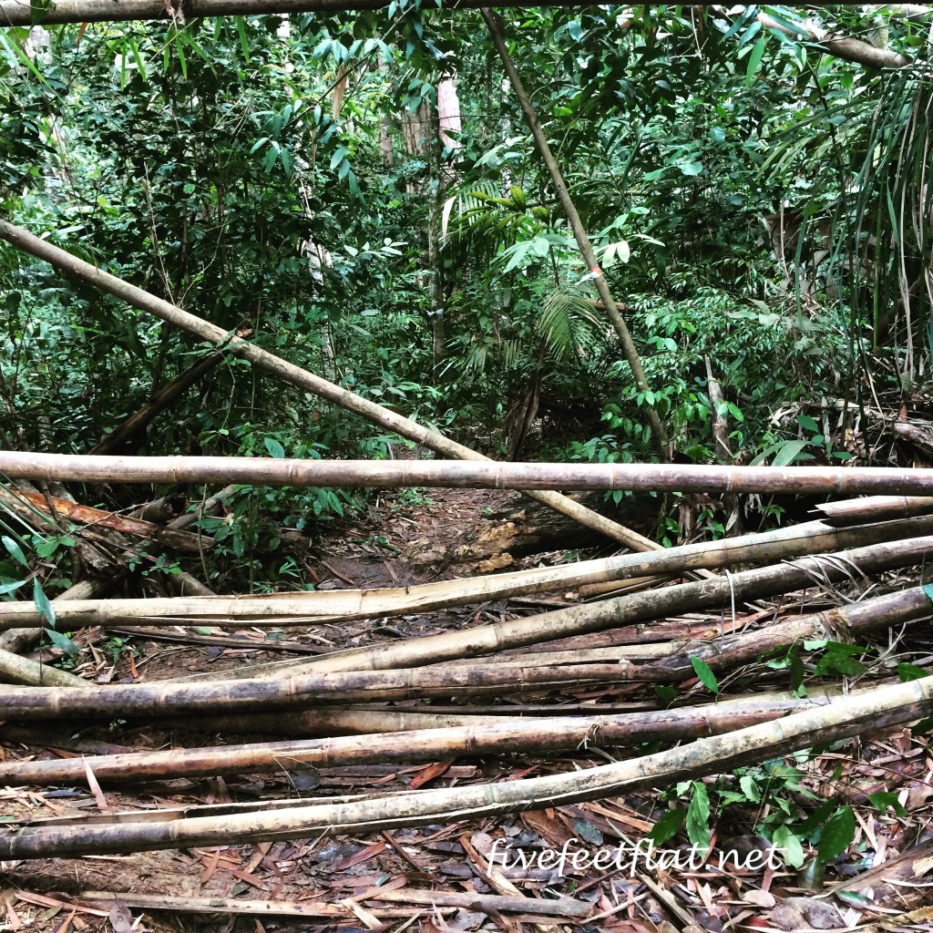
At 1,053 metres, Kutu isn’t high as far as mountains go. I’ve done Gunung Batur (1,717m) in the dark, Mount John (1,031m) in the cold and rain and hiked up to 16km in a day. What’s challenging about Kutu are the things you find there- the steepness in certain parts; the length of the steep sections; the thick bamboo jungle, where you can cut yourself if you’re not careful; the tree roots, which can serve as steps but can also be slippery on your descent; and finally, the rocks that you’ll have to either climb over or around.
Mix these elements together and you’ll have a combination that can ruin your experience if you view these obstacles as larger than they are and lose sight of the real goal- reaching the top and after that, reaching the bottom.
It’s easy for me to say this now, of course. It was only while descending that I was able to see Bukit Kutu for what it was: just a hill, and that I needed to complete the hike just as I had completed my other hikes.
The first 45 minutes into the walk up Bukit Kutu is deceiving, because much of it is flat. If you’re coming from Kuala Kubu Bharu, head for the Sungai Selangor Dam and look out for signboards for an Orang Asli village called Kampung Pertak. Turn into the village and follow the road until you reach a sort of clearing where you can park your car.

In happier times, before the grumbling began. Photo by Mani.
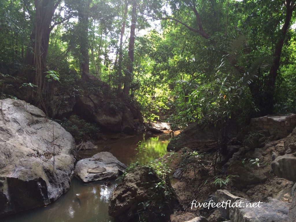
From here, follow the gravel road and you’ll reach your first river crossing. This is Sungai Pertak, which you’ll cross by bridge.
The second water crossing will come soon after. Here, the bridge has fallen on its side so you’ll need to walk along the section that is above the water, which was a bit slippery on the day I went hiking. You might prefer to ignore the broken bridge and wade in the water instead.
About ten minutes or so after the second bridge, you’ll arrive at the third water crossing. No bridge here, so you’ll need to take your shoes off and walk across. The water only reached up to our calves that day but the rangers told us that during the rainy season, crossing the river can get dangerous. The current is strong at times of heavy rainfall and the water has been known to reach waist level.
If you get impatient and eager for some real climbing by this time, the good news is that the trail starts to get interesting after this. The trail will start to climb after the river crossings, giving you an idea of what Bukit Kutu is all about.
As you climb higher, you’ll notice that Kutu is primarily a bamboo jungle. There are also durian trees and other fruit trees I forgot to ask the rangers about but all along the way, you’ll pass through thick jungle and you’ll see many fallen trees across your path. Whether you go over or under depends on how high they are above the ground.
Crossing over or going under fallen trees isn’t really the problem. What’s important is making sure that your legs are free from sharp branches as you walk through the jungle. On my way up, I saw fresh drops of blood on fallen pieces of bamboo. I was too taken aback to take photos.
The trail will climb steadily upwards and go on for about two hours until you reach a boulder called Batu Tedung. I had reached that boulder with the rest of the group but mistakenly thought that the peak was nearby, so unlike them, I didn’t bother to go beyond that point immediately. In fact, I lingered at Batu Tedung for 45 minutes and had my lunch there until I thought, “Okay, let’s see what’s around the corner.”
There was nothing ‘around the corner’ but the continuation of the trail and it hit me that I was nowhere near the peak! By that time, except for three other climbers behind me, my group had long disappeared.
I wasn’t excited at the prospect of climbing even farther but I knew it would be silly of me to turn back or stay there. It was time to stop complaining and walk on. And so although I would bump into and sometimes overtake other people now and again, I ended up completing the last hour to the top on my own.
Bukit Kutu was my first Malaysian peak above 1,000ms. The height of the mountain- that’s what it is, despite the name ‘bukit’, which means hill- isn’t remarkable but it’s the character of the mountain that may take you by surprise if you don’t hike regularly. I love hiking but I don’t do it as often as I should and I found the steep sections to be a challenge.
Having said that – and I don’t believe I’m saying this- I might want to try Kutu again, because despite the burning in my thighs, it was a good hike. This time I’ll make sure to get on the boulders at the top. If you live anywhere near the Klang Valley, Kutu is a great mountain to try out.
It was only towards the end on my way down that I began seeing Bukit Kutu as just another hill to get down from despite the slippery roots, the pain in my knees and my fear of falling, which I’ve had since I was a child. And if it was just another hill, surely all I had to do was to quit grumbling and to go on walking.
*Big thanks to Tourism Selangor, which organised the hike up Bukit Kutu as part of their TSDayOut events. These are monthly outings, open for free to anyone and always fun. There’s lots more to Selangor than most people know, so make sure to follow their Facebook page for updates.
© 2015, Anis. All rights reserved.


I remembered my first time hiking bukit kutu… someone on my team underestimated it as we were told it was a beginner hiker’s trail and he brought only a small mineral bottle. Halfway up.. he finished his water, became dehydrated by then. And very tired!
Thankfully the team helped to keep him hydrated until we reached the top where we ended up taking water from a well there, cooking it and ate maggi with it. hahaha. Such memory!
Small bottle of mineral water? Aiyo. Nasib baik the team helped him out. I brought 2 liters and even then I finished it on my way down. Luckily I had left another bottle in Adam’s car! I would still agree that it’s a beginners’ trail, just not a first-time hiker 😀
Small mineral water??
I bawak 3 liter air pun tak cukup!
I had a bad feeling when the first 45 minutes was all flat and easy, knowing that we definitely would have to negotiate steep climbs along the way.
Interested in another hike after Raya? 🙂
I know, kan. I remember asking, ‘So where’s this hill??’ LOL.
Now that you mention it, after Raya does sound good. I’m warning you though, I can be slow at times- I have knee and back issues and they’ll act up since we’ll be bringing water and going up and down.
If you go further after you have reach the top of bukit kutu, u will find an abandoned
building which was said to b a holiday residence for the British before.
Are you referring to the bit with the chimney? Yes, I saw that 🙂
So, Devi was right after all. We might wanna do it all over again! Please let me know Anis if you plan to go. But I hope I wouldn’t have to see that ‘other’ you again. Hahaha
I always expected that I would want to do this again, even on that day itself. Just like working out, the euphoria that one gets after a long hike is exactly why people keep on doing it.
p/s: Too bad! That ‘other’ me is always lurking in the background, ready to emerge in the ‘right’ circumstances 😀
How long does it take for the whole trip? A day is enough?
Hi Velysia 🙂
A day is fine. It takes about 4 hours to go up and 3 and a half hours to go down, though if you’re fit, you can do it in less time. Just make sure you go down at 3.00pm at the latest so that you reach the bottom before it gets dark. If you drink a lot of water like me, I would recommend 3 litres. I brought 2 litres but I finished it all on the way down!
Described well…
Thanks Renu!
Nice article! planning to hike up-there very soon